
UPDATE: Dineo to make landfall today
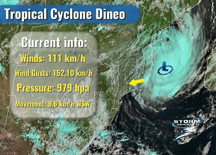
Latest readings from Tropical Cyclone Dineo as of this morning
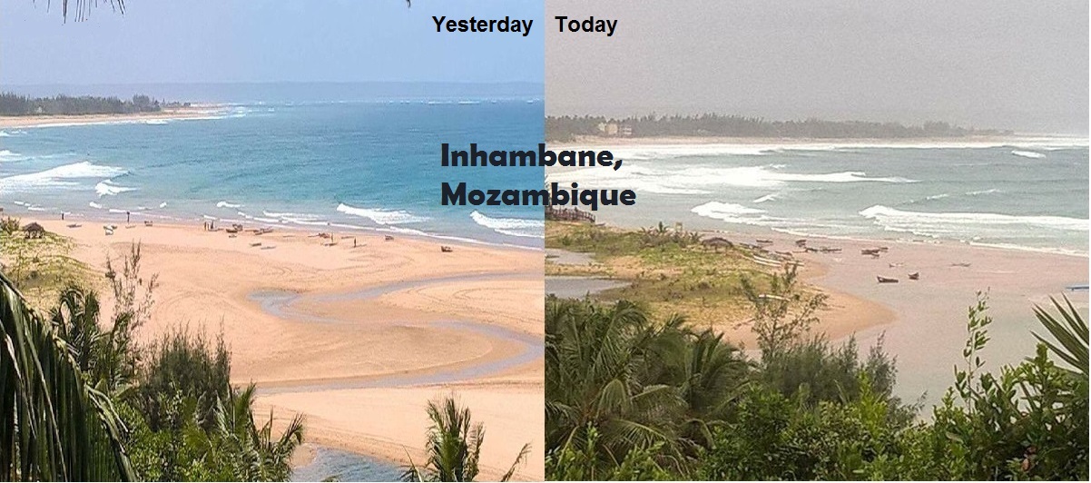
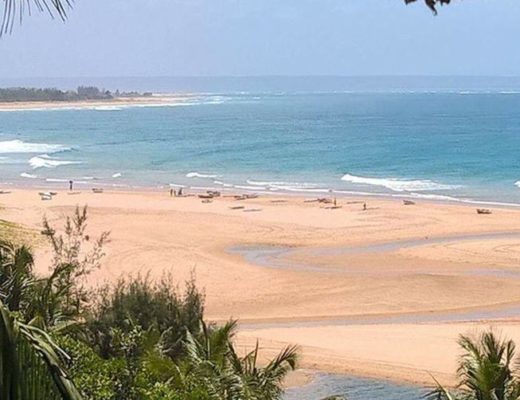
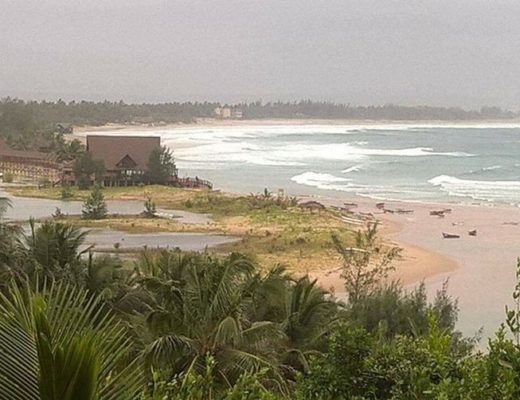
EXPERTS are expecting tropical cyclone Dineo to make landfall today just to the north of Inhambane, Mozambique.
According to Storm Report SA, who initially picked up on the information after NASA issued a warning of the possible cyclone on Sunday evening, the trajectory of Dineo has change slightly from last night and will now be moving over the extreme northern parts of SA.
‘Dineo has picked up some speed and is now moving WSW at 9,6 km/h.
‘Dineo is still gathering strength and now has wind speeds of 111 km/h and wind gusts of 152,10 km/h with a pressure of 979 hpa.
‘As soon as Dineo makes landfall today she will start to dissipate. Heavy rains can still be expected over Mozambique and the north-eastern parts of SA.’
Experts predict that Dineo will cause havoc in its path. Winds in excess of 100km/h with driving rain over areas with weak infrastructure and housing will cause damage.
Storm Report SA noted that heavy rain can be expected over the following areas:
KwaZulu-Natal:
• St. Lucia
• Jozini
• Vryheid
Mpumalanga:
• Kruger National Park
• Nelspruit
• Lydenburg
• Skukuza
• Barberton
• Kamatipoort
Limpopo:
• Phalaborwa
• Musina
• Louis Trichardt
• Tzaneen
• Mokopane
• Polokwane
However this forecast is subject to change as these systems are extremely hard to predict.
It has changed much over the past 48 hours and could change again.
The South African Weather Service (SAWS) has issued a weather advisory for north-eastern KwaZulu-Natal, the Lowveld of Mpumalanga and Limpopo – heavy rain and flooding with average wind speeds of 60 km/h from Thursday night to Saturday.
SAWS yesterday noted that there is an obvious concern for communities in southern Mozambique where torrential rains will result in widespread flooding.
‘Along the southern coastline of Mozambique, strong and damaging winds as well as sea conditions are expected to become very rough.
‘In addition to the overall risk faced by coastal communities, the threat of storm surge will be particularly pronounced on the forward flank (south-western) side of the system. This is owing to the combined effect of storm motion as well as winds swirling clockwise around the system.
‘Assuming landfall near Inhambane, the coastline north of Xai-Xai will be particularly vulnerable to storm surge.
‘While heavy rainfall in SA may occur in places over the Lowveld and adjacent escarpment regions on Thursday evening, the greatest impact with respect to South African provinces is suggested to be on Friday when heavy rain can be expected over the entire eastern half of the Limpopo (including the Kruger National Park), where 100 to 200mm of rain could occur per day.’
HAVE YOUR SAY
Like our Facebook page and follow us on Twitter.
For news straight to your phone invite us:
WhatsApp – 072 069 4169
Instagram – zululand_observer